Displays & Flight Route Mapping

LIVE FLIGHT TRACKING AND WEATHER INFORMATION ON POWERFUL MAPS FOR BETTER QUALITY FLIGHT DISPLAY BOARDS, WEB AND MOBILE CONTENT

Flight tracking and route maps for Flight Information Display Boards (FIDS) and travel tech solutions

Flight Information Displays (FIDS) offer an easy and accessible way for clients and customers to visualize flight data and understand current flight conditions through the use of our live airline route map. With online flight path mapping, commercially they can showcase the extent of your network and your status as a destination airport.

blank block
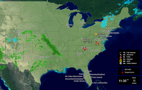
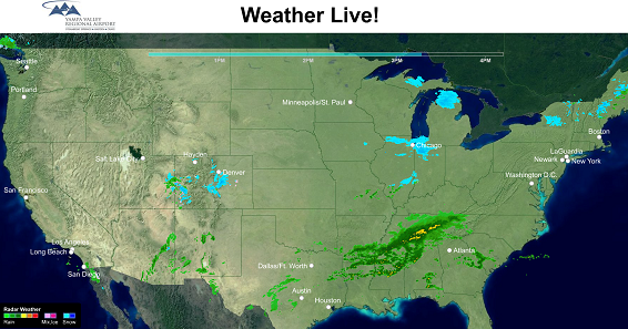
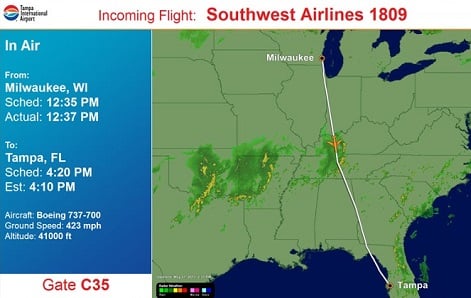
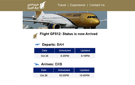
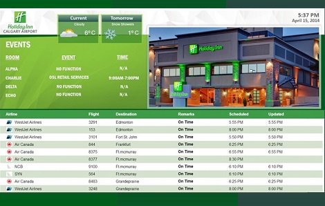
For passengers they present real time ‘at a glance’ weather and flight information on a range of devices, enhancing passenger experience and customer service at every stage of their journey. Underpinned by OAG’s definitive airline schedules database and infrastructure, they provide the detail travelers want and the reassurance they need.

Routemapper

Routemapper

Showcase your airport routes and connections through an easy-to-integrate, interactive map.

Maximize your online influence by ensuring customers can access airline and airport route information in the most impactful way. Demonstrate your airport's network and connection strengths by mapping it on a global travel landscape. Overlay the places of interest, cultural and commercial hubs that make it a significant and exciting destination.

Air Traffic Live

Air Traffic Live

Current airport arrivals and departures detailed on a compelling high-resolution map.

Show current air traffic congestion and how close specific flights are to landing, with the option of weather overlay. Help travelers and those collecting them make the right decisions by providing live airline flight path mapping information in real time.

Weather Live

Weather Live

Weather mapping tool to help travellers understand conditions at other airports.

National or regional map displaying animated radar weather, shown on a configurable loop, overlaid on a user-friendly map. Pair with Air Traffic Live to include flight status information to help customers understand the cascading effects of weather on their downstream flights.

Flight-In-Sight

Flight-In-Sight

Help customers answer the question: “Where’s my plane?” at a single glance of an airport monitor.

In-air position feeds and radar data provide unambiguous information about the location and heading of flights, offering accurate airline route maps for customers and passengers. Global ADS-B feeds and the FAA’s ASDI feed in North America eases pressure on airport and airline staff to disseminate changing information.

Airport Delays

Airport Delays (US only)

Current national or regional airport status displays.

Help travelers plan around delays and cancellations with current national or regional airport delay displays. Overlay a 4-hour weather loop to help them understand the causes of weather-related flight delays at their destination via user-friendly flight route maps.

Flight Information Displays

Flight Information Displays (FIDS)

Current arrival and departure flight status to enable travelers to react quickly and re-organize their day of travel plans in the event of delays.

One of the central parts of a day of travel experience, our market-leading FIDS displays can be deployed anywhere travelers need to see them, from ticket counters and baggage claim to hotel lobbies and conference centers. Use the flight route data as a whole display, or integrate with third party content like shown here.

REQUEST A FREE TRIAL